Drove more than I like today. We are staying at Pillar Bluff Winery tonight. The owner met us when we pulled in and gave us a wine tasting session. We aren’t oenophiles but we did like one so bought a bottle of Cabernet Blanc, and then he left. We are alone on his vineyard now. Walked the property twice. Ate sandwiches we bought earlier at Schlotsky’s. I just finished reading, Peggy’s already asleep. It’s a nice place, quiet, secluded. His grape vines were killed by the winter’s of 2018 and 2019. He didn’t have any vines left for 2021 to kill. He plans to close up shop soon. He sells the last of the bottles from his grapes and he makes wine from grapes purchased from vineyards nearby.
Peggy wants to see Marble Falls tomorrow. It’s supposed to be an attractive place. There’s a roadfood.com spot there where we’ll probably have lunch, then we’ll make some progress toward home later in the day.
Two life species here, Scissor Tailed Flycatcher and Bewick’s Wren
This day we went west toward Cottonwood and Santa Elena canyon. Cottonwood area is very similar to Rio Grande village on the east side of the park, a strip of green with willow and cottonwood trees. We hiked Sam Nail ranch trail and Homer Wilson ranch trail, as well as the area around Cottonwood CG.
Abandoned in 1945, this ranch house was built by carefully fitting nearby stones together. The roof is local timber which was cattails and “thatch”. It was amazingly cool inside. Homer Wilson Ranch
Santa Elena Canyon is near the western end of the park. The Rio Grande flows through this narrow gap.
Now that’s what I call a wall. Over 200 feet, about 20 miles long
The shear vertical cliff on the left is in Mexico, on the right in USA. The river is in the gap, it immediately turns left, east. See the gradual upward slope at the base of the right-side cliff, here is a view from there…
Four hikes and a lot of driving. From the Persimmon gap entrance to Santa Elena canyon is 60 miles, 120 round trip.
The night before we stayed at Stillwater RV park again. We tried our ask the CG host if there were any spots gambit, and yes there were two yesterday, day 1, in Rio Grande CG. But you can’t pay by putting money in an envelope, and then sliding that into a post, the usual way campgrounds do it. No, here you must pay by going onto recreation.gov The CG host had cancelled the two spots when campers left early, one of them he cancelled the day before but neither of the spaces became available on recreation.gov. This night we’re at Fort Stockton Resort and RV park, a gravel parking lot on the edge of Fort Stockton, with decent shower and good internet. Ate at Dickey’s, a Texas BBQ chain. San Antonio tomorrow, or farther.
New birds today: Black Throated Sparrow, Golden Fronted Woodpecker, Red Naped Sapsucker, Road Runner.
Big Bend is a sprawling park; two entrances but most enter through Persimmon gap gate. As you enter you see country just like the west Texas range land, desert, you’ve been driving through for miles, and miles. There may be slightly more brush and slightly more greenery due to the lack of grazing in the park. There are three interesting areas of the park, Rio Grande village, Chisos Basin and Cottonwood. We went to the first two on day one.
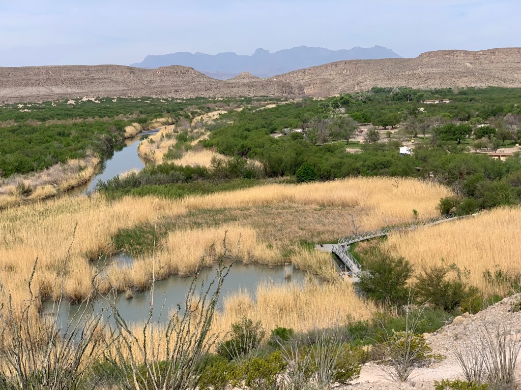
It’s roughly 40 miles from the entrance to Rio Grande village. The landscape is Creosote shrubs, Yucca and Prickley pear cactus, then suddenly you come over a slight hill and look down on a green strip of land dominated by cottonwood trees, willows and cattails. The Rio Grande creates a 1/4 mile strip of green on either side. Here are some pictures…..
They say the marshy area in the immediate foreground is a beaver pond. The elevated walkway is part of the nature trail from the campground. The Rio Grande is just a stream, ankle deep in places. Apparently almost all the water in it comes from the Mexico side of its drainage. We suck as much water out of it as drains into it from the US side. The picture above is from a small hill looking upstream, west. Of course that’s Mexico on the left.
This picture is from the same hill looking south. There is a small Mexican town just a 1/2 mile downstream and many Mexican families could be seen, out for a stroll along the river. The drive from the entrance to this trailhead was over 40 miles.
The best area in the park is Chisos Basin. Smack in the middle of the park, it is an island of green in a sea of barren-ness. As you drive you climb about 2,000 feet then descend a little into the basin, a bowl shaped alpine landscape with very different flora from either the desert or the riparian zone. Here is a picture of “the window”, a gap in the shear rock walls that surround the basin. This is of course where water runs out toward the Rio Grande…..
The high rocky mountains you see on both sides of the window are surrounding, 360 degrees, except for this gap. It was noticeably cooler, and greener than any place other than the strip of green along the river. Eastern species such as white tailed deer live here, but nowhere else nearby for 100’s of miles.
Not many new birds, a little disappointing, Gray Hawk, tons of Vermillion Flycatchers (not new for me but have only seen one, a lost bird in Florida), Pyrholuxia.
One thing John Steinbeck* knew, traveling with a dog is an ice breaker. You meet and converse with more people when you have a dog with you. As I sat on the front porch of Stillwater’s general store a leather faced cowboy rode up on a Harley, got off and admired Sammy. After a brief conversation he said “My dog’s a hog dog”….”a catahulee”. Turns out there is such a dog, a catahoula. The only dog breed to originate in Louisiana, possibly bred by the choctaw indians. They are indeed used to work hogs, and cattle.
* Travels with Charlie, read it one summer in high school
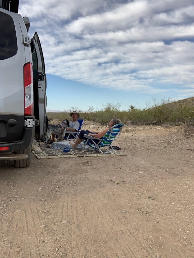
The drive Monday 3/29 from Las Cruces to Stillwater RV park was through bleak west Texas scrub country, at first on I 10, then on an almost perfectly straight ribbon of asphalt called Texas state road 90. The park was full so we chose to stay at Stillwater RV park and general store. The office/store is the converted living room of a house. Hallie Stillwater’s Hall of Fame Museum is next door, free admission but you have to get them to unlock it. The landscape was monotonous the entire drive, just west Texas desert; flat rock and gravel strewn land with occasional butte or mesa, at times high enough to qualify as a mountain. The park campgrounds are full and Stillwater RV is the closest to the entrance, plus its only $20. Here we are at our luxurious campsite…..
It’s basically a place scraped level in the desert. The store, the owner’s home really, and restroom is about 3 city blocks away. No cell phone or internet. The best part was the intense quiet, and the beautiful night sky.
New life birds here were Scaled Quail, Say’s Phoebe and Crissal’s Thrasher.
* A line from a movie that kept going though my mind as I drove 6 hours across that God awful Gene Autry country. Hat tip to anyone who knows the movie. I can’t remember it.
After Mesa Verde we decided to spend the night at a Cracker Barrel in Gallup NM. About 7 other RV’ers did the same. This was Sat 3/27. On Sunday we drove from Gallup to Las Cruces with a stop in Albuquerque’s Costco to replenish gas and propane. We ate lunch at a road food.com place, Garcia’s Kitchen. Had NM’s signature dish, Chile rellenos, then on to Hacienda RV park in Las Cruces (clean, showers great). The southern 2/3’s of NM are bleak. The highlight was seeing the many orchards along the Rio Grande. The latter is sucked almost dry by towns, agriculture and invasive water loving plants. It’s barely a stream here.
Yesterday in Moab we met an Ausiecol*. At the dog park today, 3/27 we encountered an Ausielab, and a Cowboy Corgi. The latter was really cute. The owner explained the breeder purposefully back crossed a blue healer with a welsh Corgi in order to get a corgi with longer legs. “So their belly won’t get dirty”, she explained. Both breeds are cattle dogs so the ability to herd cattle isn’t diminished.
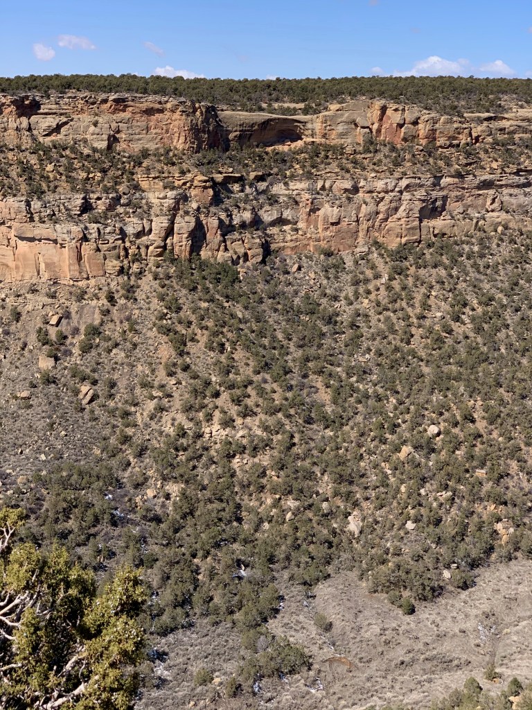
This was the least crowded of the parks so far. Maybe because it’s not fully open until May 15, or maybe because it’s at 8,700 feet elevation and the coldest park. The Campground was closed so no chance of scoring a space. Like the other parks there is one road in but one of the many side roads off of it is quite long. Still that road was closed (Wetherill), and will be until May 15. The park’s full season is only 5 months.
We’ve all seen pictures of the cliff dwellings. But I didn’t realize the extreme, precarious nature of the dwellings from the pictures. They seem inaccessible. Apparently the Indians used ladders, ropes and carved toe and hand holds in the cliffs in order to come and go. Imagine every day climbing a shear cliff 40 to 60 feet. Here are some pictures. The dwellings are always under an overhanging rock so are nearly always in shadow.
To the left and right is a shear vertical cliff. The canyon below is extremely rugged and steep. Another cliff dwelling. Imagine getting to it, imagine small children living there.
The rooms are small, there may be 60 rooms in the largest cluster of dwellings. Why build on the cliff, and why live at such an extreme altitude, where soil is thin and rain is sparse. The valley below, the Mancos valley where we spent the night, is around 6,500 to 7,000 feet elevation and the soil seemed decent. The mesa top where they planted the three sisters has thin rocky soil. They lived in this area from around 500 AD to 1300 AD when they abandoned it.
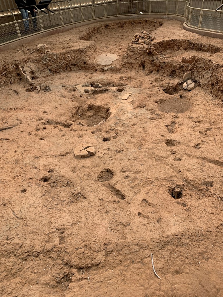
Before living on the cliffs, the earliest of these Indians lived in pit houses on top of the mesa. Here is one…..
This one was built around 700 AD. It’s 2.5 feet deep and would have been surrounded by posts with wattle and daub between them, like we see at Angel Mounds. The oval at the top of the picture was the entry way, the rectangular extension of the pit at 2:00 was essentially the pantry. Grain, dried berries and nuts, and other stable goods were stores there. That’s the actual pit with very little excavation. Later pit houses were deeper and slightly larger. The last stage of their construction was the cliff dwellings. No one understands why they moved from pit houses on top of the mesa to cliff dwellings or why they eventually abandoned them.
Two life birds added today, a Clark’s Nutcracker and a Mountain Bluebird. I’ve seen them both in the distant past but never reported them to ebird until now. Saw a probable Ferruginous Hawk but won’t report it because I’m not sure of the ID. Saw 5 species of birds total, the above 3, house finch and junco!
Finished at 3:00 PM. Took Sammy to the Cortes dog park, he loved it. Them pow wowed on tonight and tomorrow. Decided to take the plunge and go for Big Bend. We’ve had enough cold weather and aren’t quite ready to go home. We are in the parking lot of Gallup NM’s Craker Barrel. There are 6 other RV’s here Should get to Big Bend day after tomorrow.
We drove from Canyonlands to Moab to replenish groceries. Ate at a food truck (Quesadilla Mobilla), the number one rated “restaurant” in Moab on Trip Advisor. It was very good. Then we took Sammy to the dog park, he loved it, then on the road to Cortes and a Harvest Host site called Mancos Pizza. Mesa Verde is 9 minutes away. Mancos is a microbrewery. The beer we had was very good, the food was fine. The parking lot is 50/50 mud and gravel and I got stuck driving to the RV site where the gravel peters out and is mostly mud. One of the owners has a tractor out back and pulled me out. On the way here we stopped at a small park in Cortes to bird watch. Two new life birds, Cinnamon teal and Marsh Wren. Then we noticed another dog park. Sammy loves being chased by other dogs so we spent 30 minutes there before coming to Mancos Pizza. On to Mesa Verde tomorrow.
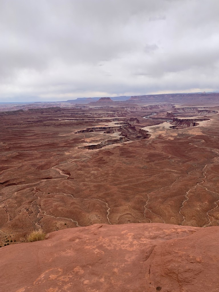
The drive from Arches to Canyonlands was only about 35 minutes. Canyonlands NP is divided into three sections by the two rivers that dominate it, the Colorado and the Green. Their confluence makes a Y that is in the center of the park. We drove into the center of the Y, called Island in the Sky. The eastern side of the Y is Needles, the western side of the Y is the maze, there are no paved roads into it. The road from the east which we took dead ends at the cliff above the rivers. The entrance to the Needles is from the south, over an hours drive from where we started at Arches. Canyonlands was the least interesting of the parks. Here is a picture of the Green river from the cliff above it.
I’m standing about 10 feet from the edge. If it looks like a wasteland or moonscape to you, it did to us too. The river turns left and meets the Colorado. There is another vista point overlooking the confluence, it looks just like this picture but you can’t see either river, they are too deep in the canyon. The La Sal mountains could be seen from Canyonlands.
The Colorado river is down there somewhere.
We got to camp inside the park again, 3 for 3 now. This time we got a spot in a first come first serve CG. The main campground is in Needles section, it requires a reservation. We didn’t go to Needles and on a whim drove through the small campground in Island in the Sky and got lucky again.
It snowed hard on the campground starting around 9:30. I was seriously worried for a while, but it only lasted about 20 minutes. All snow was a melted by 9:30 when we left.
One new bird, Juniper Titmouse. Not rare at all but I hadn’t seen one yet. The two I saw were one of only three species I saw in the park.